Welcome to our new web site!
To give our readers a chance to experience all that our new website has to offer, we have made all content freely avaiable, through October 1, 2018.
During this time, print and digital subscribers will not need to log in to view our stories or e-editions.
Nearly five inches of rain fell in the overnight hours of July 3, causing flash flooding and power interruptions, and damaging county roads. Another inch and a half fell the following night.
…
This item is available in full to subscribers.
We have recently launched a new and improved website. To continue reading, you will need to either log into your subscriber account, or purchase a new subscription.
If you had a login with the previous version of our e-edition, then you already have a login here. You just need to reset your password by clicking here.
If you are a current print subscriber, you can set up a free website account by clicking here.
Otherwise, click here to view your options for subscribing.
Please log in to continue |
|
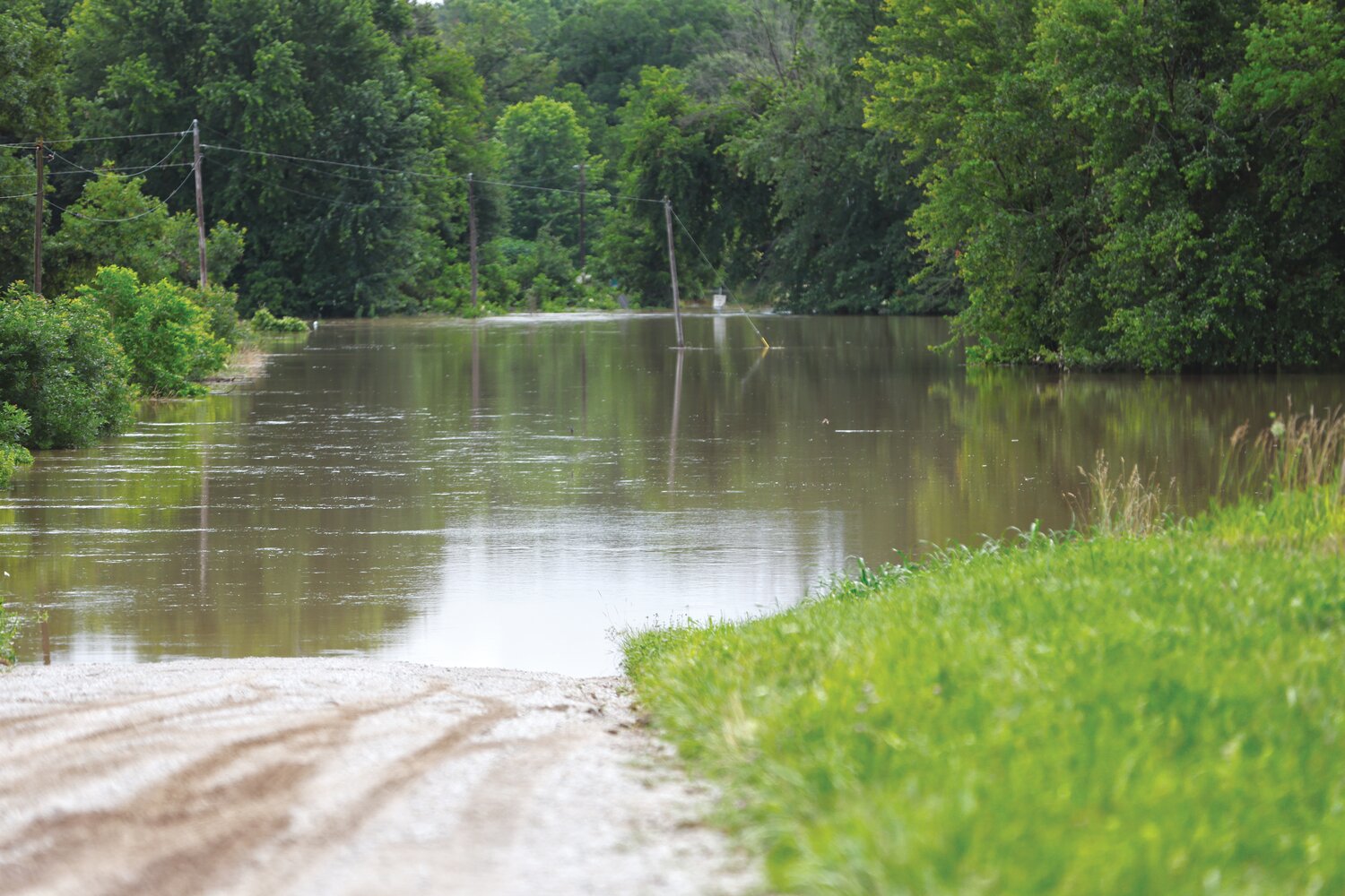
Nearly five inches of rain fell in the overnight hours of July 3, causing flash flooding and power interruptions, and damaging county roads. Another inch and a half fell the following night.
Major flooding of Salt Creek (seen right) occurred where County Roads 448 and 467 meet in southern Howard County near New Franklin.
Howard County Western District Commissioner Mat Freese said there was quite a bit of washing out of gravel roads, particularly in the southeast portions of the county, but floods didn’t damage anything that can’t be repaired.
“It took a lot gravel off a lot of roads,” he said.
Freese anticipated that damages will not be significant enough for the county to receive any rescue funds from the State Emergency Management Agency. “I doubt we will be able to reach that threshold,” he said.
Additionally, water was reported over a few blacktops, including Route Z near the Old Franklin river bottoms.
The Missouri River at Boonville crested at 26.82 feet midday on Friday, July 5, and 30.15 feet at Glasgow shortly after midnight on Saturday, July 6.


Comments
No comments on this item Please log in to comment by clicking here